Nov. 22 morning update:
The
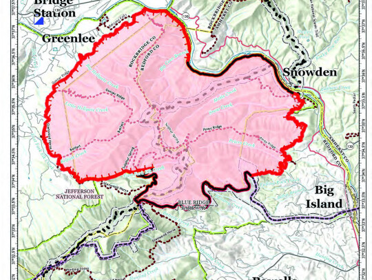
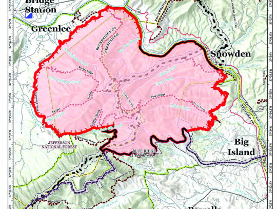
Tuesday’s rain came to 3.5 inches, delivering over 1.1 billion gallons of water across the 11,020 acres of the
“I do want to let everyone know that everything out there is looking really, really good. A lot of hard work done prior to the rainfall has paid off,” said Troy Floyd, with planning operations on the fire, in an update posted Wednesday morning.
“As the rainfall came in yesterday, upwards of 3 inches of more, across the fire area, the major threat has been removed, with the help of the firefighters and mother nature,” he said.
As of noon Tuesday, the fire was at 11,016 acres, and was 33% contained. There was minimal growth in the last 24 hours, but the containment has jumped to 57%.
Over the next few days, crews will be using drones to scan the area to check for any areas of heat that need to be addressed.
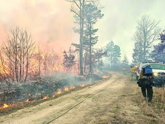
The weather provided a relief for firefighters, who spent yesterday training and repairing equipment, and are back out patrolling fire lines and repairing areas damaged in the suppression effort.
“But as it dries up today crews are re-engaging, to address rehabilitation needs as far as lines that need to be repaired, and make sure that we’re mitigated all hazards to the general public,” said Floyd.
At its peak, 380 firefighters and support staff were working on the
“We will be starting a lot of demobilization, which means getting fire fighters released, and home, and heading back over the Holidays,” said Floyd.
“We’d like to thank the general public for everything they’ve done for providing their support and understanding and being here for us.”
Petites Gap road remains closed between Belfast Road and the Blue Ridge Parkway. The Parkway itself was reopened late yesterday, though fire crews will continue patrolling.
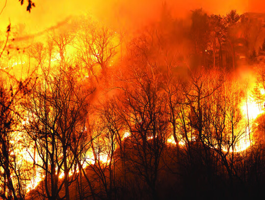
Tuesday afternoon - A soaking rain Tuesday is helping put an end to a massive wildlife on National Forest lands on the Bedford-Rockbridge County border that brought heavy smoke to the area over the past week.
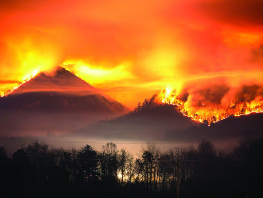
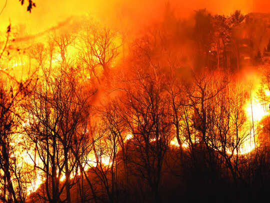
What the Forest Service called the Matts Creek fire, which started in Bedford County just over a week ago, had grown to an estimated 11,016 acres by Tuesday morning.
“With the much-needed rainfall and the actions over the last 48 hours and through the night, we do want to emphasize that the major threat to the general public has been taken away in protecting all these areas,” Troy Floyd, with planning operations on the fire, said in an update posted yesterday morning.
“Over the next 24 hours we’re going to see how much rainfall we’re going to get in the general area. Our incident meteorologists are forecasting anything between 1 to 3 inches over the next 24 hours, which is a substantial rain for this time of year, so that’s really worked out well,” Floyd said.
As of noon Tuesday, the fire was considered 33% contained.
“Due to the ongoing rain, fire spread is nearly impossible,” according to fire behavior analyst Greg Titus Tuesday. “Do not expect to see active fire today.”
“Due to the good work done to contain the fire, lack of active fire and concern over public and firefighter safety during heavy rain, firefighters will take a pause from field operations today and focus on training and equipment maintenance at the Incident Command Post,” according to the Forest Service update Tuesday. Firefighters were to return to the fire area today, Wednesday, to continue their containment work.
The Matts Creek fire was first reported on Nov. 12, burning five miles southeast of Glasgow, in the Bedford County area of the James River Face Wilderness.
It spread rapidly, from 15 acres on Nov. 13, to 150 acres on Nov. 14 to about 1,400 acres on Nov 15.
By Friday, when firefighting operations were turned over to a federal incident management team, around 5,100 acres were burning.
As of noon on Monday, the size of the fire had doubled again, reaching 10,106 acres.
Some of this expansion was due to controlled burns, which were used to direct the fire into terrain where firefighters could work more safely.
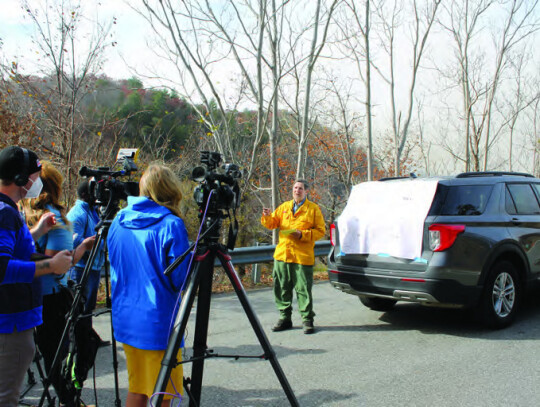
“Essentially, we had a wind change that was looking at giving us a north to east wind push today, and looking at that, yesterday, we had all this open edge on the west side of the fire,” said Dave Walker, operation section chief, at a press conference on Monday at the parking lot for the James River footbridge at Snowden, which had been closed since the start of the fire.
The western side of the fire had reached Rockbridge County by the weekend, with the first flames being spotted by county residents on Thursday night.
The James River and controlled burns limited the fire’s expansion to the north, and another fire line had been established on the south side, in the area of the Blue Ridge Parkway. However, the western edge was still largely uncontained late Sunday, so firefighters took action before the wind increased.
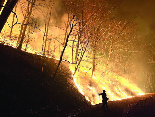
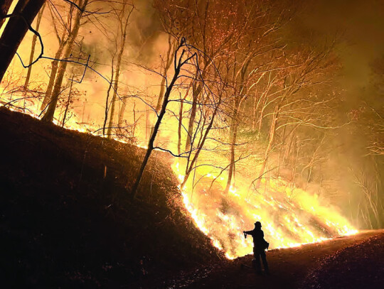
“So the conditions were such that we reacted,” Walker said. “Instead of sitting and waiting for several days for the fire to come down to our line, down on the lower elevations where we can engage safely, we took advantage of those conditions and started lighting out the ridges and let the fire do its thing and work, much like a prescribed fire, down slope.
“We had beautiful conditions [Sunday]. Light winds allowed us to use aerial resources, a helicopter and PSD [plastic sphere dispenser] machine, to drop ignition on the ridges and light the ridges, so that we could get fire established on the ridgelines and working down off the slopes in a very slow methodical fashion,” he said.
“Through the night that fire continued to progress off the ridges and down to the flats, where firefighters can safely engage,” he said.
On Monday morning, this operation was working as planned.
“So today, we woke up this morning, being in that position, where fire is down to the lines in certain places, and we’re engaging that and mopping up those edges, and then doing a little bit of additional lighting, down below, still keeping that fire behavior very low, and bringing fire out to the line, before the rain comes in tomorrow,” said Walker.
“Then we’ll have a nice clean product to work with to mop up and ensure that our fire is on the downward side of being mopped up contained and controlled,” he said.
Despite the growth in the total area of the fire, the overall containment continues to increase, from 2% Saturday to 15% Sunday to 27% Monday to 33% by noon on Tuesday.
“If you look at the actual mileage on the perimeter or a 10,000-acre fire, 27% of that, that’s over a quarter of that perimeter,” Walker said Monday. “And then, when the fire comes down to the lines [on the west edge], you’re going to see this number jump up fairly rapidly.”
Progress continued on Tuesday.
“Over the last 24 hours crews were able to take the lines and bring the fire down and hold it, all down the western side down the Arnolds Valley Road, all the way up through Petites Gap, and all the way around Division Delta [a quadrant of the firefighting effort], the lower end on the Blue Ridge Parkway,” Floyd said in his Tuesday morning update.
“Crews did a really good job hot-spotting yesterday, and then of course we’ve got the rainfall coming in, so we’ve pretty much taken all the threat to the public and fire spread out of play over the last two days.”
At the Monday press conference, Walker said that the emphasis is on protecting firefighters and resources over limiting the size of the burn.
“In order for us to keep the fire small, we’d have to engage the fire on very steep, rugged ground, which increases the exposure to all our firefighters, our aerial resources. etc.,” he said.
“So, as we look at this fire and as we came in to help the local agencies here, we have to look at a long-term strategy of how best to do this safely, cost-effectively, and of course meeting the needs of the resources well,” Walker said.
The growth of the fire and the controlled burns brought it into lower elevations, which is safer for firefighters.
“If we get down to the lower edges, the slopes are less. It’s easier to meet the fire, under our terms, with higher probability of success. As so, because of that, it’s a larger footprint. Instead of several hundred acres, or a thousand or two, you’re looking at 10,000 acres,” said Walker.
“But, we’ve done it in the right conditions, with low fire behavior, the intensities are low. It’s just like a nice, managed, prescribed burn, meeting resource objectives and meeting safety and cost containment efforts,” he said.
The fire has been contained on National Forest land, and no structures have been damaged. -An estimated 40 firefighters were on the scene the day after the fire was reported. As of yesterday morning, that number had jumped to 380, including firefighters and support teams.
A command operations center was set up in the Stonebridge Building, formerly Natural Bridge High School, late last week.
Firefighters have been called in from across the country. “We have people from all over the country, based on their skill level,” said Joe Mazzeo, information officer, at a press conference Friday at an overlook on U.S. 501 just east of Glasgow.
Federal help left local fire departments free to respond to calls as needed.
“That’s why we’re here. So we free up the local volunteer departments to respond to things in their district. We don’t want them tied up, helping us, and then have something happen, in their community, and not have anybody to help,” Mazzeo said.
Volunteer firefighters responded to one such call Sunday, Nov. 19, when a small fire was reported off Hercules Lane near Snowden.
By Tuesday, this fire was contained at .75 acres, and determined to have been started by human activity, unrelated to the larger fire.
While cause of the Matts Creek fire is still undetermined, Walker said Monday that the size of the fire shouldn’t impact an investigation at the origin point.
Drought conditions in the area and a buildup of leaf litter contributed to the speed with which the fire spread.
“This area in Virginia is going through a very significant drought. It’s 30-plus days without any appreciable moisture,” said Walker.
“With every single day that ticks by without moisture you have a compounding of reduced moisture in the fuels, making the fuels much more available and much more explosive, leading to faster, more intense, and larger fires that become harder to contain, harder to control,” he said. - Firefighters will be back at work today, Wednesday, continuing containment efforts and repairing areas damaged in the fire suppression efforts.
“We are getting a handle on the fire spread of the Matts Creek. Mother Nature has come in, the timing was just perfect and helped us out, and all the hard work that the crews did throughout the last several days and the last weeks,” Floyd said in his Tuesday morning update.
“It’s helping to reduce all the threat, get all the smoke out of the area that residents have been trying to deal with, and get everybody back where they can return and have a great Thanksgiving, and that’s something we’re really happy about and want to thank everybody for.”
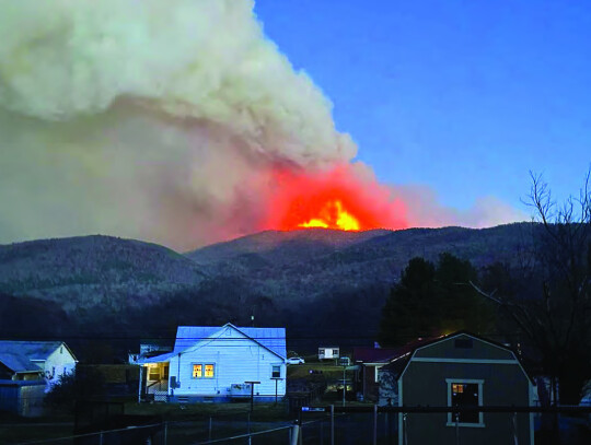
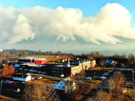
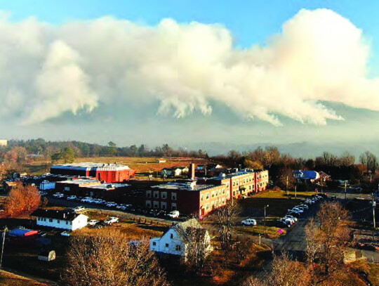
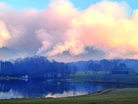
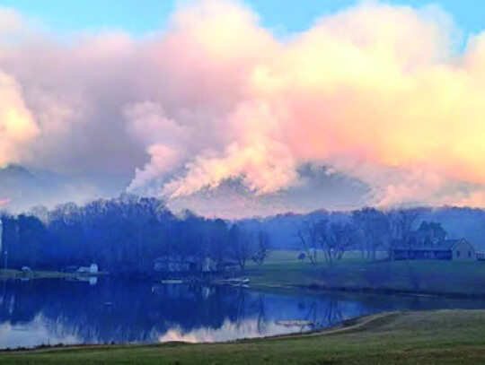
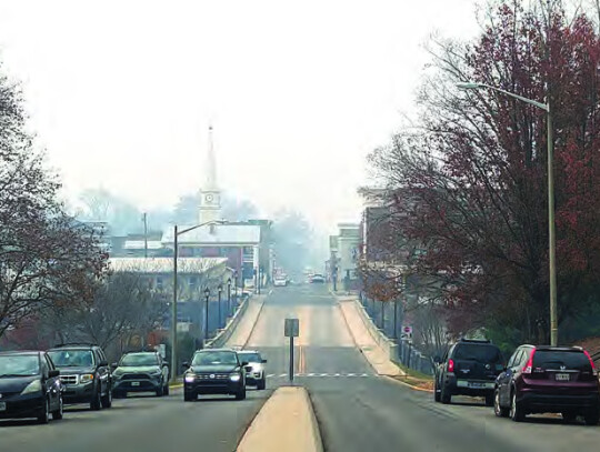
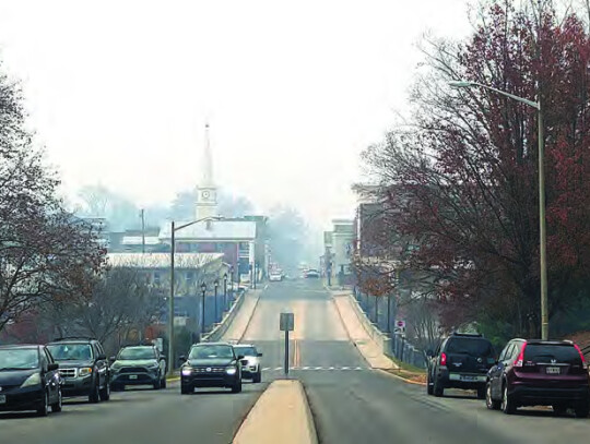
Smoke from the fire had been a major issue in the Rockbridge area, reaching hazardous levels last Wednesday through Friday before winds shifted much of the smoke to the east over the weekend. Much of the smoke this week has been limited to the Glasgow-Natural Bridge areas.
Rockbridge, Buena Vista, and Lexington schools were closed Thursday and Friday of last week and Monday and Tuesday of this week due to concerns about air quality.
The Forest Service smoke outlook predicts minimal smoldering and smoke impacts for the next few days.
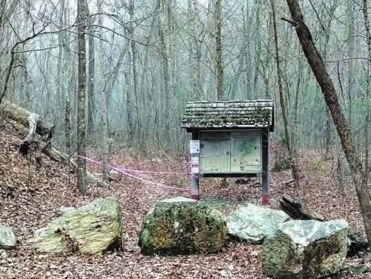
Sections of the Blue Ridge Parkway and the Appalachian Trail have been closed during the firefighting efforts, as has the James River Face Wilderness and all associated trails.
Though the threat from the fire is contained, Floyd advised that some closures may remain in effect due to concerns about damaged trees or debris.
Updates can be found by going to inciweb.wildfire.gov and selecting the Matts Creek Fire, or on the Facebook page of the Washington-Jefferson National Forest.
.jpg)

